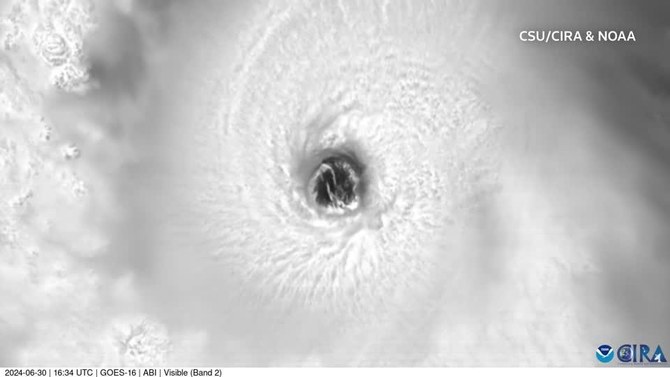
(Reuters): Hurricane Beryl barreled across the Atlantic Ocean toward the Caribbean’s Windward Islands as an “extremely dangerous” storm on Monday, threatening to devastate communities with floods, storm surges and life-threatening high winds, officials said.
Locals boarded up shops, stocked up on food and filled their cars with petrol as the storm approached. The prime minister of St. Vincent and the Grenadines, Ralph Gonsalves, said he was expecting a natural disaster that could continue for days.
It was an unusually fierce and early start to this year’s Atlantic hurricane season — the earliest Category 4 storm on record, according to National Hurricane Center data on Sunday.
Beryl had weakened earlier on Monday to Category 3 and then picked up again to 4 on a five-point scale, packing maximum sustained wind speeds exceeding 193 kph, with some higher gusts, about 180 km southeast of Barbados, the NHC said.
It would likely bring catastrophic winds and a storm surge early on Tuesday in the Windward islands, it said.
“Beryl is expected to remain an extremely dangerous major hurricane as its core moves through the Windward Islands into the eastern Caribbean,” the NHC warned.
It advised people in the storm’s path to take heed of authorities’ advice on evacuations and preparedness.
Hurricane warnings were in effect for Barbados, St. Lucia, St. Vincent and the Grenadines, Grenada and Tobago. A tropical storm warning was issued for Martinique and Trinidad, with storm watches for parts of the Dominican Republic and parts of Haiti.
Tobago has opened shelters, closed schools for Monday, and canceled elective surgeries in the hospitals, authorities said.
The hurricane is expected to bring 8 to 15 cm of rain across Barbados and the Windward Islands throughout the day on Monday, which the NHC warned could cause flash flooding in vulnerable areas.
Large, dangerous swells are also expected to batter the southern coasts of Puerto Rico and Hispaniola.
The US National Oceanic and Atmospheric Administration in May predicted above-normal hurricane activity in the Atlantic in 2024, amid near-record warm ocean temperatures.
Hurricane Dennis became a Category 4 on July 8, 2005, according to NHC data, making it the second earliest on record in the June-November season.


