F.P. Report
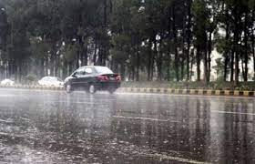
LAHORE: Most parts of north-eastern and upper Punjab received heavy downpour on Saturday.
The latest spell of rains is again a result of monsoon current from the Arabian Sea penetrating the upper and central parts of Pakistan with a westerly affecting the region at the same time, resulting in intense downpours.
Hence, the combined effects of the two systems are producing heavy rains despite the fact that the monsoon currents are moderate in their intensity. Although global warming has increased the rain intensity around the globe, convergence of hot and cold winds due to two systems [monsoon currents and westerly] makes downpour even more likely. In fact, the overwhelming majority of intense rains, especially in northeastern Punjab, this season is a result of their interaction.
The reason behind this trend is the gradual strengthening of westerlies due to global warming as they contain more powerful than in the past because of the increasing amount of moisture they carry. Thus, any interaction with monsoon currents produces extreme weather events in the shape of heavier downpour or even cloud burst. In Lahore, the downpour with wind started around 3:30 which was soon followed by a drenching thunderstorm. Although, rain had stopped around 9:30am, the city and other parts of northeastern Punjab were still covered by dark clouds.
The highest amount of rain 156mm recorded in the city was at Qartaba Chowk followed by Lakshmi Chowk 138mm, Gulshan-e-Ravi 142mm, Gulberg 121mm, Nishtar Town 107mm, Paniwala Talab 107mm, Tajpura 103mm, Farrukhabad 97mm, Iqbal Town 92mm and Johar Town 88mm. However, the rain clouds initially had started developing over western Punjab around midnight, which moved towards central and eastern Punjab, resulting in heavy rain along its path.
According to the Met Office, the chief amounts of rain recorded in some other towns and cities of Punjab are: Jhelum 74mm, Mangla 72mm, Narowal 46mm, Joharabad 38mm, Mandi Bahauddin 32mm, Kasur and Faisalabad 28mm, Hafizabad 27, Gujranwala 26, Islamabad (Zero Point) 26mm, Sialkot Airport 24 and Chakwal 23. Earlier, it was expected that the heavy rains during the last weekend and earlier this week would end the hot and humid conditions. But the delay in monsoon withdrawal means that the humidity level had again jumped.
On Friday, isolated rain was reported from Islamabad and upper Punjab on Wednesday after the monsoon currents and the westerly started affecting the region. The spell will continue during the next 36 to 48 hours. Reuters had reported on Tuesday that India will receive heavy monsoon rains at the tail end of the four-month season, the chief of the weather office said on Tuesday, bringing farmers succor after the driest August in more than a century hit some summer crops amid higher food prices. It means delay in monsoon withdrawal may also have effects on Pakistan, producing more rains in the country.
But if the monsoon current continues reaching Pakistan with rains in the cotton belt – southern Punjab and Sindh – then it can adversely affect the crop yield. The extreme weather events with high temperatures, erratic or intense rains and droughts mean Pakistan immediately needs to work on adjusting crop pattern so that it can secure future needs and achieve sustained food security.