Andrew Freedman
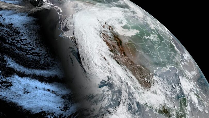
Tropical Storm Hilary is bringing the likelihood of “catastrophic and life-threatening flooding” to California Sunday, while prompting unprecedented tropical storm warnings for Los Angeles and San Diego.
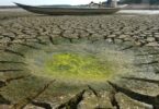
Threat level: The storm is not only dumping two years or more worth of rain in California’s desert areas. It is also bringing tropical rainfall rates, which can be torrential, to areas that have never experienced them and are vulnerable to flash flooding even in more ordinary downpours.
- California is under a state of emergency due to the storm, and evacuations away from the most vulnerable areas to mudslides, debris flows and other hazards are expected today in southern California especially.
- The Weather Prediction Center has painted a large zone in southern California and Southwestern Nevada as facing a “high risk” of excessive rainfall and flash flooding on Sunday, including San Bernardino National Forecast, Death Valley, Barstow, Indio, and Palmdale, Calif. (The Coachella music and arts festival is held each year in Indio.)
- High risk-designated days are associated with about 40% of all flash flood-related fatalities and 83% of all flash flood-related damages in the U.S.
State of play: As of 11:30am ET, Tropical Storm Hilary was packing maximum sustained winds of 70 mph, located about 220 miles south-southeast of San Diego, and was moving north-northwest at 25 mph.
- This fast-forward speed is likely to prevent the storm from dropping below tropical storm status before it reaches the California border.
- Weakening is expected, but Hilary is expected to remain a tropical storm before it reaches southern California, the National Hurricane Center said it its latest advisory.
- The NWS office in San Diego is advising residents to avoid unnecessary travel Sunday “due to the high flooding potential.” In an online forecast discussion, the NWS termed the flood threat there as “rare and dangerous.”
Zoom in: The heaviest rain and strongest winds are expected in southern California between Sunday morning and the evening, local time.
The intrigue: The WPC’s heavy rainfall forecast discussion notes the likelihood of localized rainfall totals of up to 10 inches, along with mudslides, debris flows and other life-threatening hazards.
- The rainfall rates are likely to be beyond many Californian’s lived experiences, since tropical storm systems tend to churn out precipitation with ruthless efficiency.
- Some of the rain could pile up at torrential rates of 3 inches per hour, forecasters warned. The amounts of water vapor in the air, which is then converted into rainfall, are likely to set all-time record highs for the Southwest, the WPC stated.
- Forecasters noted that some computer models were predicting rainfall amounts of between 8 and 17 inches, which would be unheard of for this region. Nevada’s 24-hour state rainfall record is in jeopardy, the WPC stated.
- The rain will not just affect California, either. “It’s looking increasingly probable that Hilary will be the wettest known tropical cyclone, post-tropical cyclone, or tropical cyclone remnant to impact Nevada (set in 1906), Idaho (set in 1982), and Oregon (set in 1976),” the WPC stated Sunday.
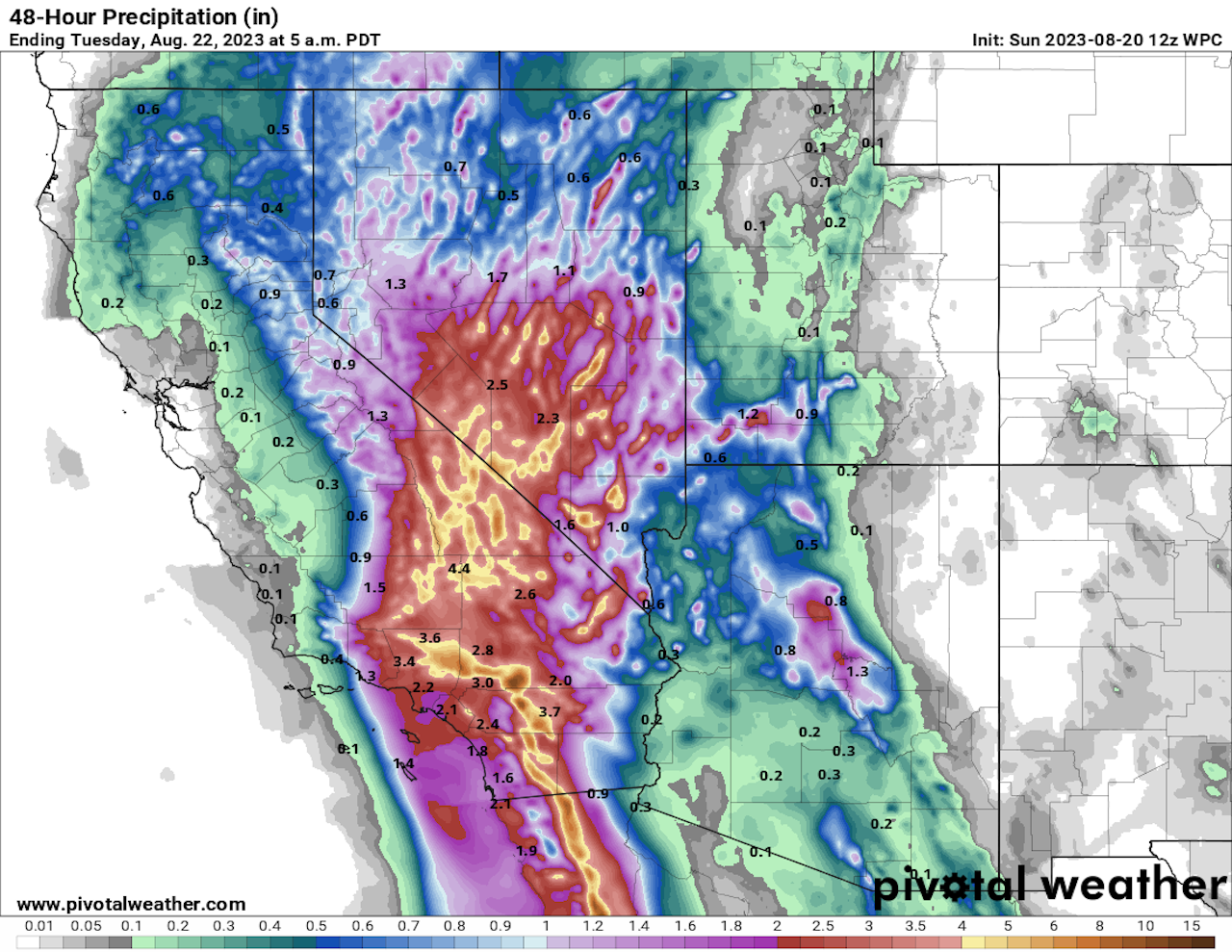
By the numbers: Rainfall totals of between 2 to 4 inches are forecast for San Diego and LA, with more significant amounts approaching 6 to 8 inches or more falling in higher elevations and desert areas to the east.
- The heaviest rains are likely to fall on the eastern and southern sides of higher elevations, as well as in desert areas closer to the core of the tropical system.
- 43 million people were under tropical storm warnings as of Saturday at midday, from the LA metro area south to the U.S.-Mexico border. Gusty winds are expected to be strongest along the coast and in areas of higher terrain.
- 28 million people in half a dozen states are under flash flood watches, which extend all the way north into eastern Oregon and Idaho.
Between the lines: Tropical Storm Hilary’s biggest threat to the Southwest region will be water, rather than high winds. This is the first tropical storm to hit California since 1939.
- That storm killed 100 people.
Context: Human-caused climate change is leading to more frequent and intense extreme precipitation events. It is also causing tropical storms and hurricanes to produce more rainfall, as a warmer atmosphere and oceans allow these storms to carry more moisture.
- The presence of an intensifying El Niño event, with above-average sea surface temperatures in the equatorial tropical Pacific Ocean, may be enhancing the moisture funneling into this storm.
- The storm increased its maximum sustained winds Thursday into Friday by an incredible 80 mph in 24 hours, more than double the rate that defines rapid intensification.
- In recent years, there has been a trend toward more frequent rapid intensification of hurricanes and typhoons, as well as larger leaps in intensity over shorter periods, which has been tied to human-caused climate change.
Courtesy: (Axios)